Portsmouth sits on a geological patchwork that changes dramatically within a few hundred metres. The dense London Clay under Portsea Island behaves very differently from the loose brickearth and made ground you encounter near Fratton or Southsea seafront. When you open an excavation in the city, the ground response is never uniform, and that is exactly why monitoring cannot be generic. The chalk bedrock lies deep beneath most of the city centre, overlain by Quaternary deposits that include silts, sands, and historic fill from centuries of dockyard expansion. Understanding how these layers interact with a temporary works scheme requires instrumentation that captures lateral deflection, pore pressure shifts, and vibration at multiple depths. We combine inclinometer arrays with automated total stations to track movement in real time, feeding data back to the site team before small displacements become costly problems. For deeper cuts near existing structures, integrating deep excavation monitoring with vibration thresholds derived from BS 5228 keeps neighbouring assets protected while the dig proceeds on programme.
In Portsmouth, the biggest risk is not the excavation depth, it is the variability of the made ground and the speed at which pore pressure can change with the tide.
Process overview
Local context
One thing you learn quickly working excavations in Portsmouth is that the tidal influence reaches further inland than the textbooks suggest. The harbour's semi-diurnal range, averaging around 4 metres, creates a fluctuating groundwater table in the superficial gravels and made ground that blankets much of Portsea Island. When pumping rates are set without accounting for this cyclic recharge, you get a sawtooth pattern in the piezometer data, and that can mask a genuine loss of passive resistance at the toe of a wall. The other local factor is the legacy of bomb damage and post-war reconstruction. Basements were backfilled with whatever was available, and that material is often loose, heterogeneous, and prone to collapse if the support system relaxes even slightly. Monitoring in these conditions means setting tighter trigger thresholds and interpreting trends, not just absolute values. If the excavation is adjacent to a masonry terrace in Landport or a listed building in Old Portsmouth, we often supplement the standard array with in-situ permeability testing to calibrate the dewatering model, ensuring that drawdown stays within the consented limits and does not trigger settlement claims.
Reference standards
BS 5930:2015+A1:2020 – Code of practice for ground investigations, BS EN 1997-1:2004 (Eurocode 7) – Geotechnical design, CIRIA C760 – Guidance on embedded retaining wall design, BS 5228-2:2009+A1:2014 – Code of practice for noise and vibration control on construction sites, BS EN ISO 18674-3:2017 – Geotechnical investigation and testing – field instrumentation
Additional services
Retaining wall and prop monitoring
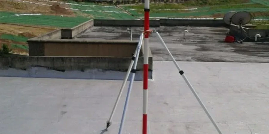
Inclinometer chains, load cells, and strain gauges on sheet pile, secant, and contiguous pile walls, with automated data collection synchronised to the tidal cycle.
Groundwater and pore pressure monitoring
Vibrating wire piezometers installed at multiple depths within the aquifer and aquitard layers, tracking tidal influence and dewatering system performance.
Building and utility condition surveys
Pre- and post-construction condition surveys using high-resolution photography, crack gauges, and precise levelling to protect adjacent assets and satisfy party wall requirements.
Typical parameters
Quick answers
What is the typical cost for excavation monitoring on a medium-sized Portsmouth basement project?
For a typical 3- to 5-week monitoring programme on a single-storey basement excavation in the Portsmouth area, budgets usually fall between £610 and £2.090 depending on the number of instruments, reporting frequency, and whether automated real-time telemetry is required. We provide a fixed-price quotation after reviewing the temporary works design and the site-specific ground investigation data.
How does tidal fluctuation in Portsmouth Harbour affect excavation monitoring readings?
The harbour's 4-metre tidal range drives a cyclic variation in groundwater levels within the superficial gravels and made ground across much of Portsea Island. Piezometer data will show a diurnal rhythm, and trigger values must be calibrated to distinguish this natural fluctuation from a genuine retaining wall performance issue. Our reporting templates account for this by comparing trends against predicted tidal curves rather than using a flat baseline.
Which British Standards govern excavation monitoring in the UK?
The primary documents are BS 5930:2015+A1:2020 for ground investigation practice, BS EN 1997-1:2004 (Eurocode 7) for geotechnical design and limit state verification, and CIRIA C760 for embedded retaining wall guidance. Instrumentation-specific requirements follow BS EN ISO 18674-3:2017 for inclinometers and extensometers, while vibration monitoring adheres to BS 5228-2:2009+A1:2014.
Can you monitor excavations next to listed structures in Old Portsmouth without causing damage?
Yes, and we do it routinely. The process starts with a detailed condition survey of the heritage asset, followed by installation of low-impact crack gauges, tilt meters, and precise levelling points. Vibration limits are set conservatively below the BS 5228 thresholds for fragile structures, and we use remote data loggers so that access to the listed building is minimised during construction.