Portsmouth’s seismic engineering demands are shaped by its complex coastal geology, including the Wittering Formation and superficial drift deposits that can amplify ground motion even under moderate UK seismicity. Our seismic category addresses these local conditions through targeted soil liquefaction analysis, evaluating saturated granular layers beneath the city’s harbour front and reclaimed land, and seismic microzonation to map variable ground response across Southsea, Portsea Island, and the M275 corridor in accordance with Eurocode 8 and UK National Annex requirements.
Critical infrastructure, high-rise residential towers, and port facilities in Portsmouth routinely require these assessments to satisfy planning authorities and insurers. For structures where standard ductility measures prove insufficient, we provide base isolation seismic design, decoupling superstructures from ground motion and protecting both heritage assets and modern developments. Our integrated approach ensures compliance with BS EN 1998 while addressing the region’s soft soil amplification and long-period basin effects.
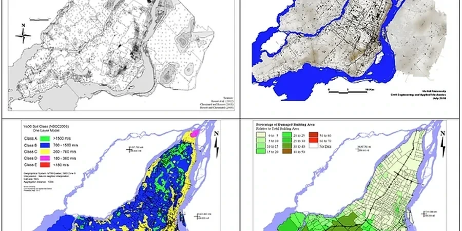
Seismic site assessment in Portsmouth addresses the evaluation of ground behaviour under earthquake loading, despite the UK's low-to-moderate seismicity. The region's geological context, shaped by the Hampshire Basin, includes Eocene London Clay, Wittering Formation sands, and superficial Quaternary gravels and alluvium, particularly around Portsea Island and Langstone Harbour. A robust ground investigation is fundamental to characterise these deposits, as localised variations in stiffness and density directly influence seismic response. British Standards, notably BS EN 1998-1 (Eurocode 8) with its UK National Annex, define the requirements for seismic hazard assessment, supported by BS 5930 for site investigation practice and BS EN ISO 22475-1 for sampling and groundwater procedures. Our ground investigation services integrate these standards to develop a reliable ground model, while laboratory testing quantifies dynamic soil properties essential for seismic analysis.
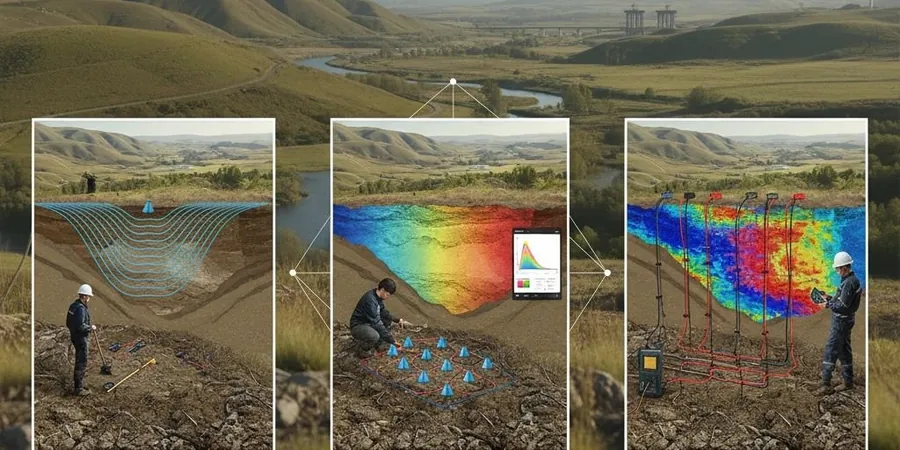
Seismic ground characterisation in Portsmouth relies on a combination of high-quality In-Situ and advanced sampling, executed in accordance with BS EN 1997-2 and BS 1377. The Cone Penetration Test (CPT) provides near-continuous profiling of tip resistance, sleeve friction, and pore pressure, enabling the direct assessment of soil behaviour type and the evaluation of liquefaction susceptibility in loose, saturated sands found in coastal areas. Complementary In-Situ methods, including seismic dilatometer and downhole geophysical surveys, measure small-strain shear wave velocity (Vs), a critical input for site classification to Eurocode 8. Where detailed stratigraphic data is needed, particularly in the stiff London Clay, dynamic sampling and rotary coring provide undisturbed materials for advanced cyclic triaxial or resonant column tests, ensuring compliance with the UK-specific ground type definitions and seismic action calculations.
Typical projects in Portsmouth requiring seismic consideration range from the redevelopment of historic naval dockyards and waterfront residential towers to critical infrastructure upgrades along the M27 and M275 corridors. Ground conditions here frequently present a sequence of made ground over compressible alluvium, underlain by the Lambeth Group and Chalk, where the contrast in dynamic stiffness governs site response. For embankment stability and earthwork design on the Portsdown Hill slopes, field density testing using the sand cone method verifies compaction levels, directly influencing the cyclic strength of engineered fill. In foundation design for multi-storey structures on the Wittering Sands, our laboratory performs grain size analysis by sieve and hydrometer and determines Atterberg limits to classify fine-grained soils, parameters that correlate with plasticity-based liquefaction resistance and form the basis of robust foundations designed for seismic durability.
Our seismic assessment process begins with a desk study and the development of a preliminary ground model, followed by a targeted field campaign integrating CPT and geophysical profiling to map impedance contrasts. All data is processed to derive Eurocode 8 ground parameters, including Vs,30 for site classification, and to identify potentially liquefiable layers. Deliverables comprise a comprehensive Ground Investigation Report with factual data and a Geotechnical Design Report containing interpretive seismic parameters, liquefaction potential indices, and recommendations for Improvement or foundation mitigation. This integrated approach provides Portsmouth developers and engineers with a single-source, code-compliant solution that de-risks ground-related seismic hazards, accelerates regulatory approval, and ensures resilient structural performance from the outset.